Map Caesarea
Plot to kill Paul
Map Caesarea
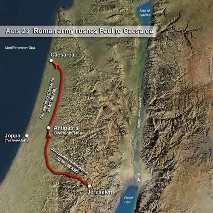
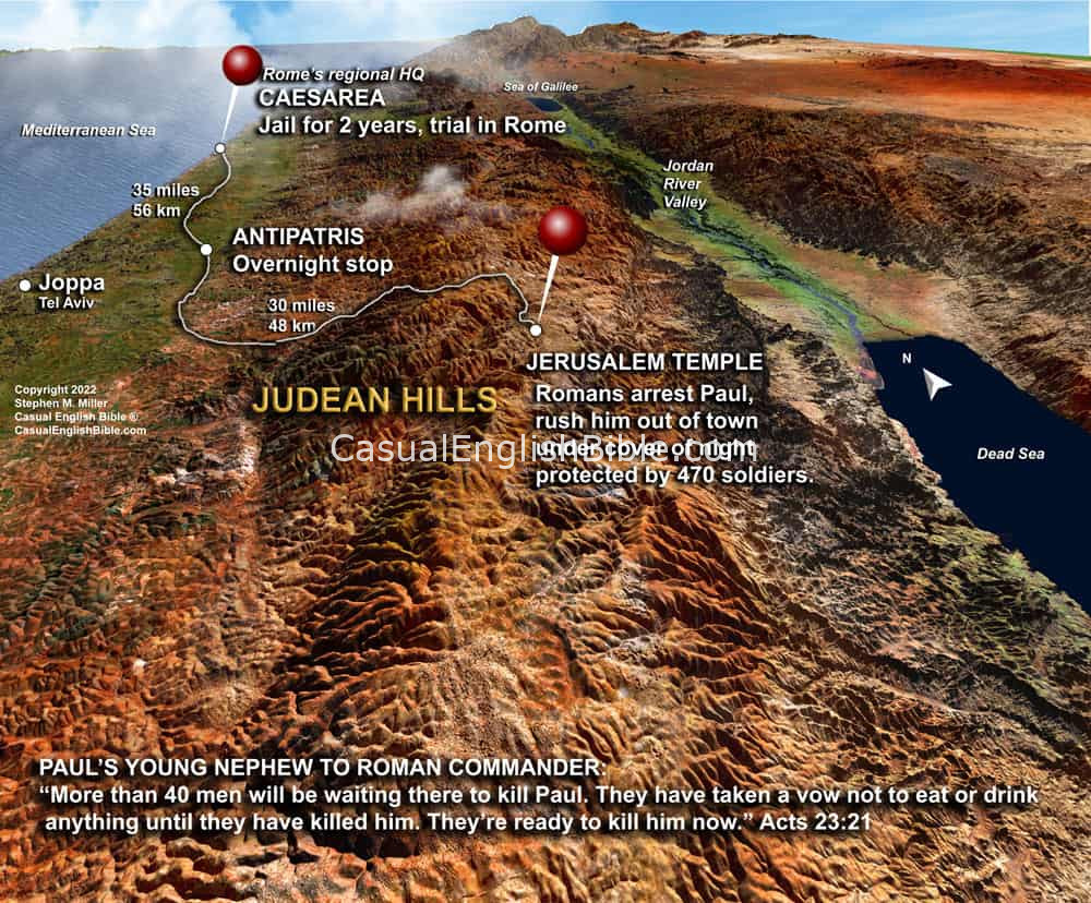
Roman army rushes Paul to Caesarea
Some Jews hatched a plot to kill Paul. They made a promise to each other. They agreed they…

The Casual English Bible® maps tell Bible stories in a captivating way that engages even people who have never read the Bible. Lavishly detailed maps only make the stories of Jesus and others more compelling and easier to picture and to understand.
These 3D-style maps of Bible lands are created from blended high resolution satellite images, matched to precise elevation data from international space agencies.
—Type “Galilee” into the Casual English Bible’s map search engine, below. Instantly, you’ll see dozens of beautiful maps…many in 3D style. Each one tracks with a different Bible story. These aren’t generic maps with a hundred place names.
—Type “Samson” into the Bible map search engine. You’ll see the tiny village where he lived in the Judean foothills below Jerusalem.
—Type “Corinthians” and you’ll see a gallery full of maps associated with Paul’s letters of 1, 2 Corinthians, to the church in Corinth, Greece.
Get a feel for the lay of the land:
—Ararat Mountains, where Noah’s boat ran aground. The Bible doesn’t say it was Mount Ararat.
—Judean hills where Joshua and the Israelites found most of their battles for the Promised Land. They avoided the plains, where their enemies with armored chariots had the advantage over Israel’s foot soldiers.
—Jesus’ 20-mile climb from Jericho and the Jordan River Valley upward half a mile high, to the crest of the Mount of Olives, overlooking Jerusalem.
—One surprise for some readers is the Jesus Triangle, a plug of ground between three cities. It’s where Jesus spent most of his ministry time. A person can walk that entire triangle in a single day. Type “Jesus triangle” to see it.

Some Jews hatched a plot to kill Paul. They made a promise to each other. They agreed they…


