Arabah Valley
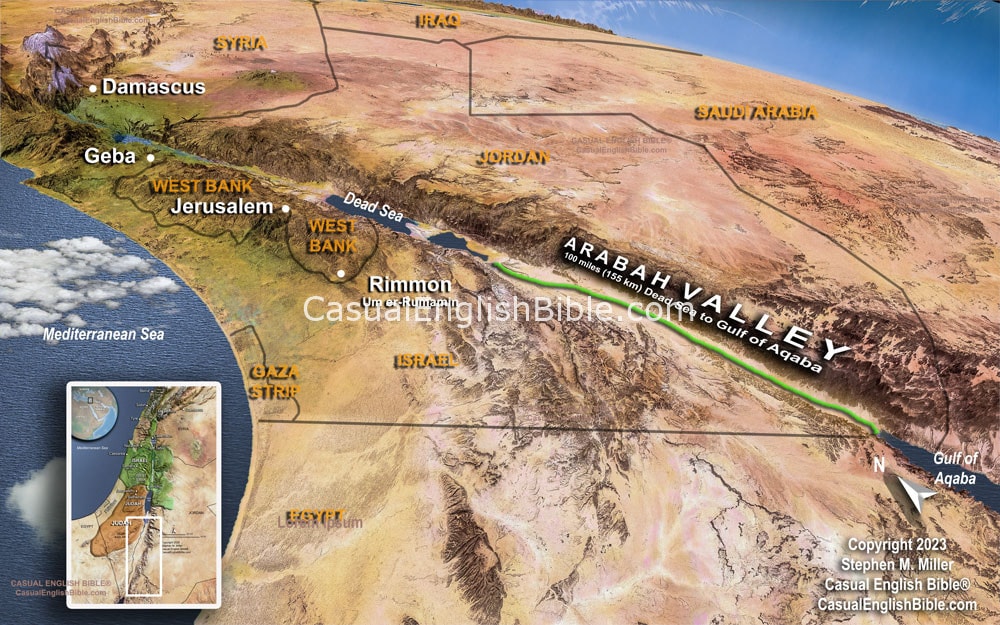
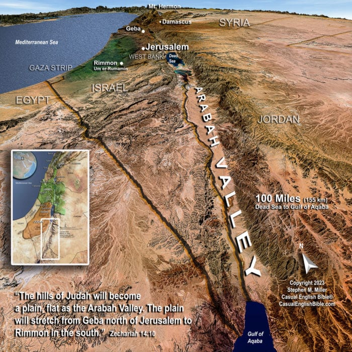
Arabah Valley south of the Dead Sea stretches 100 miles (155 km) to the northern tip of the Red Sea's Gulf of Aqaba. The valley serves as a natural border between Israel in the west and Jordan in the east.
Arabah Valley
Arabah Valley
Map Arabah Valley, a 100-mile-long (155 km) desolate valley between the Dead Sea and the Red Sea's northeastern tip, the Gulf of Aqaba. It marks the boundary between Israel and Jordan.
Bible Map Damascus, Hamath, Tyre, Sidon
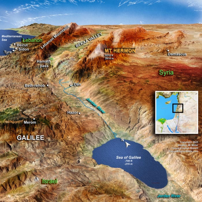
Bible Map Damascus, Hamath, Tyre, Sidon
Bible map of Damascus, Hamath, Tyre, and Sidon, which are cities and kingdoms doomed to fall, according to Zechariah's prophecy in Zechariah 9.
Map of Hosea’s world
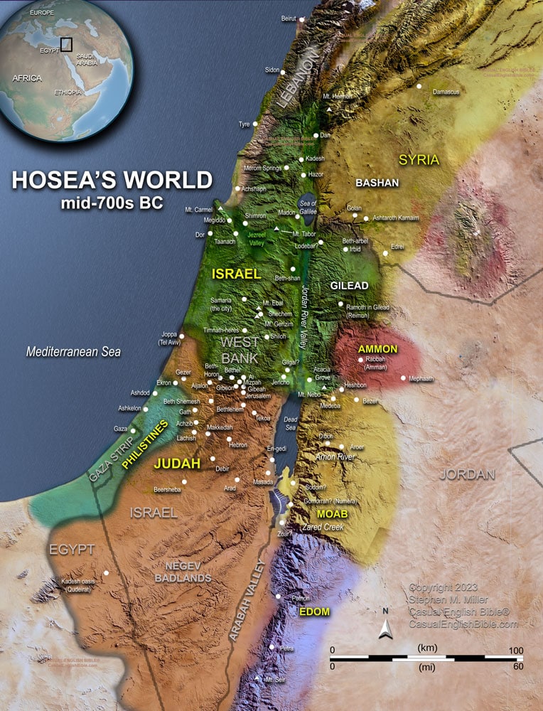
Map of Hosea's world
Map of Hosea's world of Israel and Judah and surrounding countries in the mid-700s BC.
Map Jerusalem falls
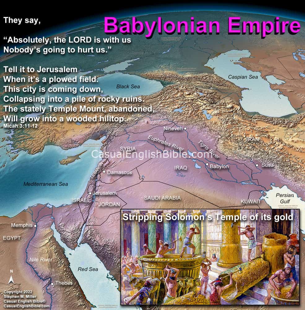
Map Jerusalem falls
Map Micah 3, Jerusalem Falls.
9 Listen to me you rulers of Jacob’s people,
You leaders of Israel
You crooks who poison justice,
And cheat fairness.
10
Map of Micah’s world
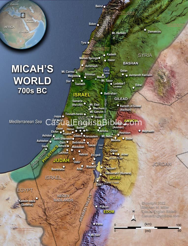
Map of Micah's world
Map of Micah's world of Israel and Judah and surrounding countries in the 700s BC.
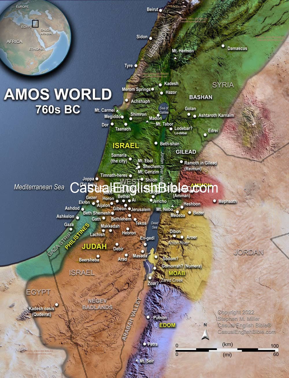
Map of Amos’ trip to Samaria
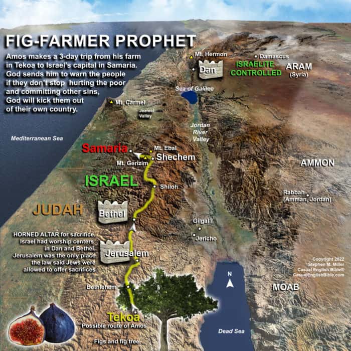
Map of Amos' trip to Samaria
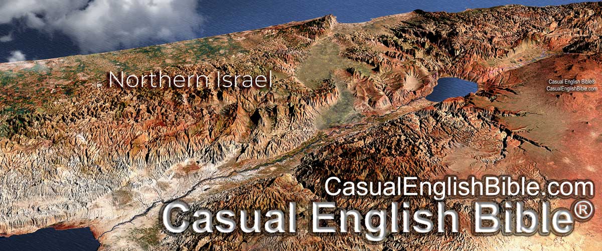
Map of Amos' trip to Samaria in the northern Jewish nation of Israel. He warns them to stop cheating the poor and most vulnerable people, and to stop worshiping at forbidden shrines and temples.

